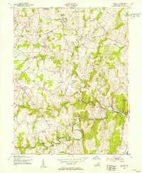
1952 Map of Lincoln
USGS Topo · Published 1953About this map
Goose Creek defines the lower half of this landscape, its winding course crossed by historical landmarks like Guinea Bridge and Garters Bridge. In the early 1950s, the rural character of Loudoun County was punctuated by a network of small settlements and religious centers, including Lincoln, Philomont, and Mountville. For genealogists and local historians, the sheet provides exact locations for several country houses of worship, such as Regular Ch, Mountville Ch, Zion Ch, and Pentecostal Ch, alongside the Goose Creek Cem. The presence of Camp Highroad and State Prison Camp No 24 reveals the specialized land use during this era. Industrial and utility infrastructure of the period is also visible, from a Quarry near the creek to the Purcellville Sewage Disposal facility in the north, reflecting the gradual modernization of these agrarian communities.
Find a feature on this map
30 named features on this map. Tap any name to fly to it.
Don’t see what you’re looking for? This feature index may not catch every label — zoom into the map to look around manually.
Map Details
Editions of this 1952 Lincoln Map
2 editions found
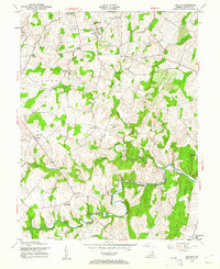
Other maps of this area

1884 · Harpers Ferry
USGS Topo · 1:125,000

1891 · Harpers Ferry
USGS Topo · 1:125,000

1893 · Harpers Ferry
USGS Topo · 1:125,000

1894 · Warrenton
USGS Topo · 1:125,000

1916 · Berryville
USGS Topo · 1:62,500

1933 · Middleburg
USGS Topo · 1:62,500

1939 · Berryville
USGS Topo · 1:48,000

1943 · Arcola
USGS Topo · 1:24,000

1943 · Bluemont
USGS Topo · 1:24,000

1943 · Rectortown
USGS Topo · 1:24,000