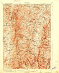
1921 Map of Lincoln Mountain
USGS Topo · Published 1921About this map
Lincoln and the mountain ridge of the Green Mountains define this high-elevation survey, documenting the rugged terrain before modern development. The map traces the famous Long Trail as it traverses prominent peaks including Mt Abraham, Lincoln Peak, and Stark Mtn. The settlement pattern follows the valley of the Mad River, where Waitsfield, Irasville, and Warren serve as centers for the upland agricultural and timber communities.
Find a feature on this map
114 named features on this map. Tap any name to fly to it.
Don’t see what you’re looking for? This feature index may not catch every label — zoom into the map to look around manually.
Map Details
Editions of this 1921 Lincoln Mountain Map
5 editions found

Other maps of this area

1902 · Brandon
USGS Topo · 1:62,500

1903 · Middlebury
USGS Topo · 1:62,500

1904 · Brandon
USGS Topo · 1:62,500

1905 · Middlebury
USGS Topo · 1:62,500

1906 · Burlington
USGS Topo · 1:62,500

1915 · Rochester
USGS Topo · 1:62,500

1917 · Rochester
USGS Topo · 1:62,500

1919 · Royalton
USGS Topo · 1:62,500

1919 · Burlington
USGS Topo · 1:62,500

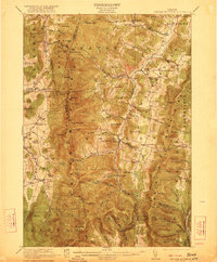
1919 · Lincoln Mountain
USGS Topo · 1:62,500