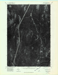
1975 Map of Lincoln NE
USGS Topo · Published 1980About this map
The Penobscot River anchors the southeastern corner of this mid-1970s orthophotoquad, serving as the primary drainage for a network of forest waterways in this Maine landscape. The confluence of the Medunkeunk River and the East Branch Medunkeunk Stream provides a clear view of the hydrological patterns before they join the larger river system. To the east, the Mattawakeunk Stream cuts through the dense timberland that characterizes the region. Elevation is marked by the prominent Pea Ridge, which stands out against the surrounding wetlands and river valleys. This aerial perspective, captured in 1975, offers a detailed look at the logging roads and natural corridors used by the timber industry and local outdoorsmen, preserving a specific moment in the land-use history of northern Penobscot County.
Find a feature on this map
5 named features on this map. Tap any name to fly to it.
Don’t see what you’re looking for? This feature index may not catch every label — zoom into the map to look around manually.
Map Details
Editions of this 1975 Lincoln NE Map
This is the sole edition of this map. No revisions or reprints were ever made.
Other maps of this area

1920 · Winn
USGS Topo · 1:62,500

1940 · Mattawamkeag
USGS Topo · 1:62,500

1942 · Lincoln
USGS Topo · 1:62,500

1942 · Mattawamkeag
USGS Topo · 1:62,500

1951 · Millinocket
USGS Topo · 1:62,500

1954 · Millinocket
USGS Topo · 1:250,000

1957 · Lincoln
USGS Topo · 1:62,500

1958 · Millinocket
USGS Topo · 1:250,000

1960 · Millinocket
USGS Topo · 1:250,000
1960 · Winn
USGS Topo · 1:62,500