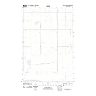
2011 Map of Lincoln Valley SE
USGS Topo · Published 2011About this map
Advent Cemetery sits in the northern reaches of this Sheridan County landscape, a marker of local genealogy within a strictly organized grid of agricultural section lines. This 2011 survey illustrates the rural character of the region, where the road network, including 14th St NE and 13th Ave NE, defines the movement across the prairie. The topography is dotted with several small water bodies, most notably Kindschi Lake and Stein Lake, which interrupt the rectilinear geometry of the fields. This specific survey provides a record of the land use and drainage patterns of the area at the start of the second decade of the 21st century, showing a landscape almost entirely dedicated to cultivation and ranching.
Find a feature on this map
17 named features on this map. Tap any name to fly to it.
Don’t see what you’re looking for? This feature index may not catch every label — zoom into the map to look around manually.
Map Details
Editions of this 2011 Lincoln Valley SE Map
This is the sole edition of this map. No revisions or reprints were ever made.
Other maps of this area

1946 · Sheyenne Lake
USGS Topo · 1:48,000

1947 · Lincoln Valley
USGS Topo · 1:62,500

1947 · Sheyenne Lake
USGS Topo · 1:62,500

1950 · Sheyenne Lake
USGS Topo · 1:24,000

1954 · McClusky
USGS Topo · 1:250,000

1958 · McClusky
USGS Topo · 1:250,000

1959 · McClusky
USGS Topo · 1:24,000

1960 · Lincoln Valley SE
USGS Topo · 1:24,000

1960 · Denhoff
USGS Topo · 1:24,000
1960 · Lincoln Valley
USGS Topo · 1:24,000