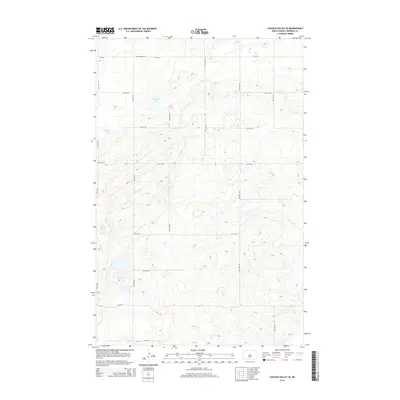
2014 Map of Lincoln Valley SE
USGS Topo · Published 2014About this map
Advent Cem stands as a quiet landmark in this section of Sheridan County, situated north of the expansive glacial depressions of the prairie. The landscape is defined by the presence of Kindschi Lake and Stein Lake, reflecting the post-glacial topography of the region. A systematic grid of section roads, including CR-4216, 13th St NE, and 10th Ave NE, provides the primary structure for this agricultural landscape. The map illustrates a contemporary view of rural North Dakota, where the placement of small rural cemeteries and localized water bodies preserves the spatial history of the early settlement era within a modern surveyed framework. This layout underscores the transition from pioneering land claims to the consolidated agricultural operations of the early twenty-first century.
Find a feature on this map
18 named features on this map. Tap any name to fly to it.
Don’t see what you’re looking for? This feature index may not catch every label — zoom into the map to look around manually.
Map Details
Editions of this 2014 Lincoln Valley SE Map
This is the sole edition of this map. No revisions or reprints were ever made.
Other maps of this area

1946 · Sheyenne Lake
USGS Topo · 1:48,000

1947 · Lincoln Valley
USGS Topo · 1:62,500

1947 · Sheyenne Lake
USGS Topo · 1:62,500

1950 · Sheyenne Lake
USGS Topo · 1:24,000

1954 · McClusky
USGS Topo · 1:250,000

1958 · McClusky
USGS Topo · 1:250,000

1959 · McClusky
USGS Topo · 1:24,000

1960 · Lincoln Valley SE
USGS Topo · 1:24,000

1960 · Denhoff
USGS Topo · 1:24,000
1960 · Lincoln Valley
USGS Topo · 1:24,000