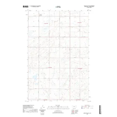
2020 Map of Lincoln Valley SE
USGS Topo · Published 2020About this map
The Lincoln Valley Seventh - Day Adventist Cem serves as a prominent landmark in this section of Sheridan County, situated along 14th St NE. The landscape is defined by the unique glaciated topography of the prairie pothole region, where numerous small wetlands and larger bodies of water like Kindschi Lake and Stein Lake dominate the terrain. The map reveals a highly structured rectilinear grid of local roads, from 13th St NE down to 4th St NE, which facilitates access to the surrounding agricultural tracts. This network of section-line roads reflects the enduring legacy of the Public Land Survey System across the North Dakota plains, organizing the rural landscape into distinct townships such as t148n r76w and t147n r76w.
Find a feature on this map
19 named features on this map. Tap any name to fly to it.
Don’t see what you’re looking for? This feature index may not catch every label — zoom into the map to look around manually.
Map Details
Editions of this 2020 Lincoln Valley SE Map
This is the sole edition of this map. No revisions or reprints were ever made.
Other maps of this area

1946 · Sheyenne Lake
USGS Topo · 1:48,000

1947 · Lincoln Valley
USGS Topo · 1:62,500

1947 · Sheyenne Lake
USGS Topo · 1:62,500

1950 · Sheyenne Lake
USGS Topo · 1:24,000

1954 · McClusky
USGS Topo · 1:250,000

1958 · McClusky
USGS Topo · 1:250,000

1959 · McClusky
USGS Topo · 1:24,000

1960 · Lincoln Valley SE
USGS Topo · 1:24,000

1960 · Denhoff
USGS Topo · 1:24,000
1960 · Lincoln Valley
USGS Topo · 1:24,000