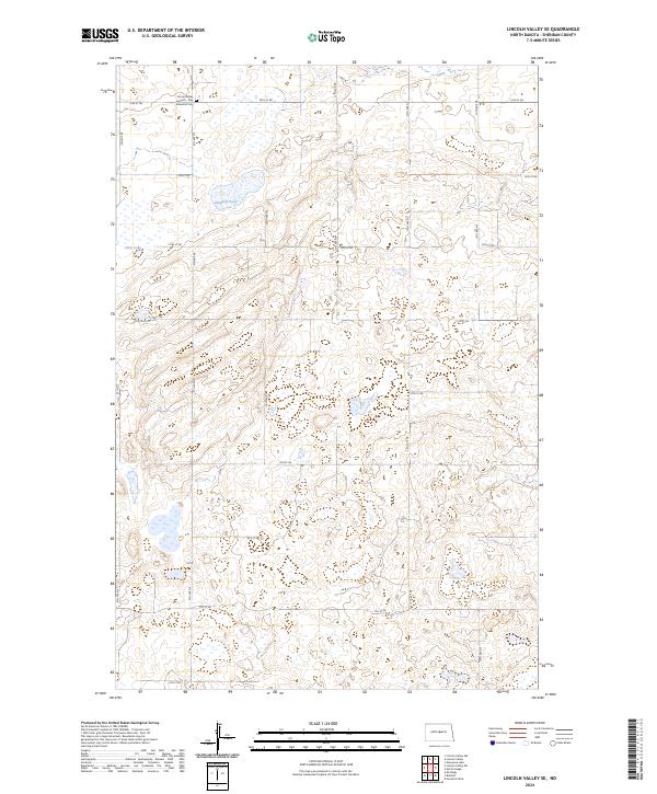
2024 Map of Lincoln Valley SE
USGS Topo · Published 2024About this map
Lincoln Valley Seventh - Day Adventist Cem serves as a primary local-history landmark in this corner of Sheridan County, situated in the upper-left quadrant of the landscape. The terrain is characterized by the prairie pothole ecosystem of the northern Great Plains, punctuated by numerous small depressions and larger water bodies like Kindschi Lake and Stein Lake. These wetlands are protected through the Sheridan County Waterfowl Production Area, which spans several sections of T148N R76W. A rigid grid of section-line roads, such as 14th St NE and 9th St NE, organizes the agricultural territory, reflecting the enduring legacy of the Public Land Survey System in defining the North Dakota horizon.
Find a feature on this map
20 named features on this map. Tap any name to fly to it.
Don’t see what you’re looking for? This feature index may not catch every label — zoom into the map to look around manually.
Map Details
Editions of this 2024 Lincoln Valley SE Map
This is the sole edition of this map. No revisions or reprints were ever made.
Other maps of this area

1946 · Sheyenne Lake
USGS Topo · 1:48,000

1947 · Lincoln Valley
USGS Topo · 1:62,500

1947 · Sheyenne Lake
USGS Topo · 1:62,500

1950 · Sheyenne Lake
USGS Topo · 1:24,000

1954 · McClusky
USGS Topo · 1:250,000

1958 · McClusky
USGS Topo · 1:250,000

1959 · McClusky
USGS Topo · 1:24,000

1960 · Lincoln Valley SE
USGS Topo · 1:24,000

1960 · Denhoff
USGS Topo · 1:24,000
1960 · Lincoln Valley
USGS Topo · 1:24,000