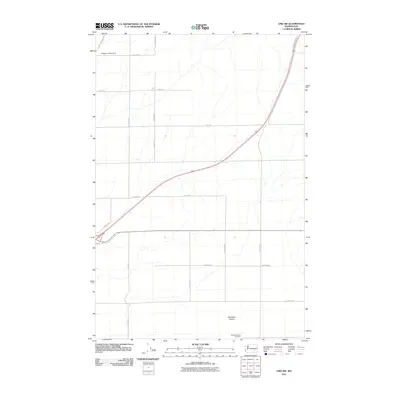
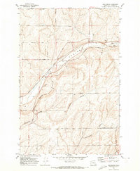
2011 Map of Lind SW
USGS Topo · Published 2011About this map
Michigan Prairie defines this corner of Adams County, where the vast agricultural plateau is marked by a precise grid of rural routes and sections. This 2011 survey captures a landscape of large-scale farming and transportation, anchored by the Michigan Prairie Cemetery in the southern reaches. The map documents the local transit network, featuring named arteries such as S Lind Hatton Rd and S Lauer Rd that connect the remote farmsteads of the region. A small aviation landmark, the Phillips Landing Strip, is situated in the northwest, providing a vital link for aerial crop management or private transport. The presence of these specific family-named roads and localized landing sites illustrates the continued reliance on both traditional land routes and modern aerial technology in managing the expansive grain fields of eastern Washington.
Find a feature on this map
20 named features on this map. Tap any name to fly to it.
Don’t see what you’re looking for? This feature index may not catch every label — zoom into the map to look around manually.
Map Details
Editions of this 2011 Lind SW Map
This is the sole edition of this map. No revisions or reprints were ever made.
Other maps of this area

1916 · Connell
USGS Topo · 1:125,000

1918 · Connell
USGS Topo · 1:125,000

1953 · Walla Walla
USGS Topo · 1:250,000

1958 · Walla Walla
USGS Topo · 1:250,000

1970 · Lind SE
USGS Topo · 1:24,000

1970 · Lind SW
USGS Topo · 1:24,000
1970 · Lind
USGS Topo · 1:24,000
1970 · Roxboro
USGS Topo · 1:24,000
1970 · Kahlotus
USGS Topo · 1:24,000
1970 · Providence
USGS Topo · 1:24,000