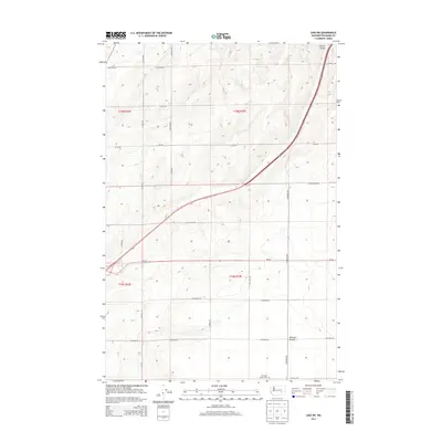
2013 Map of Lind SW
USGS Topo · Published 2013About this map
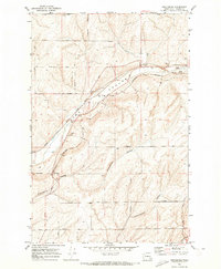
Michigan Prairie defines the southern landscape of this Adams County region, where the open expanse is marked by a grid of rural section roads and long-standing agricultural boundaries. The Michigan Prairie Cem serves as a central historical landmark, anchoring the local genealogy of the surrounding farmsteads. To the north, the terrain is carved by Hatton Coulee, which runs parallel to the modern corridor of Wa-26. This 2013 survey by the U.S. Geological Survey illustrates a highly organized township system, including portions of t16n r33e and t15n r33e. The network of family-named routes, such as S Lauer Rd and S Foulkes Rd, highlights the persistent footprint of early settlement patterns in this dryland farming country.
Find a feature on this map
26 named features on this map. Tap any name to fly to it.
Don’t see what you’re looking for? This feature index may not catch every label — zoom into the map to look around manually.
Map Details
Editions of this 2013 Lind SW Map
This is the sole edition of this map. No revisions or reprints were ever made.
Other maps of this area

1916 · Connell
USGS Topo · 1:125,000

1918 · Connell
USGS Topo · 1:125,000

1953 · Walla Walla
USGS Topo · 1:250,000

1958 · Walla Walla
USGS Topo · 1:250,000

1970 · Lind SE
USGS Topo · 1:24,000

1970 · Lind SW
USGS Topo · 1:24,000
1970 · Lind
USGS Topo · 1:24,000
1970 · Roxboro
USGS Topo · 1:24,000
1970 · Kahlotus
USGS Topo · 1:24,000
1970 · Providence
USGS Topo · 1:24,000