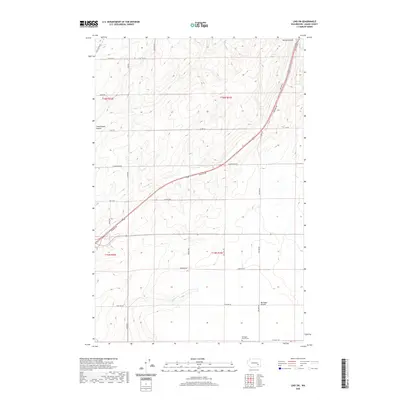
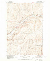
2020 Map of Lind SW
USGS Topo · Published 2020About this map
Michigan Prairie occupies the southern reaches of this landscape, a distinct geographic feature in the drylands of Adams County. The terrain is defined by the deep incisions of Hatton Coulee in the northeast and Cunningham Coulee in the northwest, showcasing the characteristic basalt-scoured topography of the region. A sparse but organized network of section-line roads and arterial routes, such as the Lind-Hatton Rd and Neilson Rd, connects the scattered farmsteads and agricultural plots that dominate the township. For those researching local pioneers, the Michigan Prairie Cem stands as a primary genealogical landmark in the southern section of the quadrangle. The placement of roads like Hoffman Rd and Hoefel Rd suggests the enduring influence of early 20th-century family landholdings on the modern rural infrastructure.
Find a feature on this map
27 named features on this map. Tap any name to fly to it.
Don’t see what you’re looking for? This feature index may not catch every label — zoom into the map to look around manually.
Map Details
Editions of this 2020 Lind SW Map
This is the sole edition of this map. No revisions or reprints were ever made.
Other maps of this area

1916 · Connell
USGS Topo · 1:125,000

1918 · Connell
USGS Topo · 1:125,000

1953 · Walla Walla
USGS Topo · 1:250,000

1958 · Walla Walla
USGS Topo · 1:250,000

1970 · Lind SE
USGS Topo · 1:24,000

1970 · Lind SW
USGS Topo · 1:24,000
1970 · Lind
USGS Topo · 1:24,000
1970 · Roxboro
USGS Topo · 1:24,000
1970 · Kahlotus
USGS Topo · 1:24,000
1970 · Providence
USGS Topo · 1:24,000