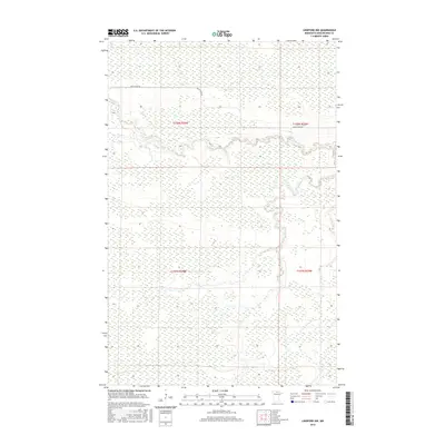
2016 Map of Lindford NW
USGS Topo · Published 2016About this map
Black River meanders across this northern Minnesota landscape, carving a winding path through the vast wetlands of western Koochiching County. The terrain is characterized by a high concentration of marshes and seasonal water bodies, typical of the boggy lowlands in the state's northern reaches. Grounded in the Public Land Survey System, the map detail encompasses portions of t158n r26w, t158n r25w, t157n r26w, and t157n r25w. This 2016 survey documents the modern drainage patterns and the lone arterial route of Black River Rd as it skirts the northern edge of the river basin, providing a record of the limited human infrastructure in an area dominated by natural hydrology and timberlands.
Find a feature on this map
6 named features on this map. Tap any name to fly to it.
Don’t see what you’re looking for? This feature index may not catch every label — zoom into the map to look around manually.
Map Details
Editions of this 2016 Lindford NW Map
This is the sole edition of this map. No revisions or reprints were ever made.
Other maps of this area

1919 · Birchdale
USGS Topo · 1:62,500

1919 · I
USGS Topo · 1:62,500

1943 · Lindford
USGS Topo · 1:62,500

1954 · Roseau
USGS Topo · 1:250,000

1954 · International Falls
USGS Topo · 1:250,000

1957 · Roseau
USGS Topo · 1:250,000

1957 · International Falls
USGS Topo · 1:250,000

1958 · International Falls
USGS Topo · 1:250,000

1958 · Roseau
USGS Topo · 1:250,000

1968 · Birchdale SE
USGS Topo · 1:24,000