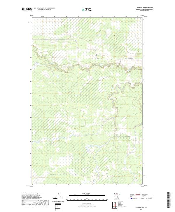
2022 Map of Lindford NW
USGS Topo · Published 2022About this map
Black River meanders across this northern landscape, defining the topography within the townships of t158n r26w and t158n r25w. The river’s winding course is the primary geographical feature of this largely undeveloped section of Koochiching County, where the terrain is dominated by extensive wetland systems. The sparse human footprint is marked primarily by Black River Rd, which skirts the northern bank of the watercourse before turning south. This 2022 survey illustrates the intersection of these remote hydrologic patterns and the established Public Land Survey System grid, including the boundaries of t157n r26w and t157n r25w. It remains a document of a quiet, water-dominated wilderness where the slow movement of the river dictates the local geography.
Find a feature on this map
6 named features on this map. Tap any name to fly to it.
Don’t see what you’re looking for? This feature index may not catch every label — zoom into the map to look around manually.
Map Details
Editions of this 2022 Lindford NW Map
This is the sole edition of this map. No revisions or reprints were ever made.
Other maps of this area

1919 · Birchdale
USGS Topo · 1:62,500

1919 · I
USGS Topo · 1:62,500

1943 · Lindford
USGS Topo · 1:62,500

1954 · Roseau
USGS Topo · 1:250,000

1954 · International Falls
USGS Topo · 1:250,000

1957 · Roseau
USGS Topo · 1:250,000

1957 · International Falls
USGS Topo · 1:250,000

1958 · International Falls
USGS Topo · 1:250,000

1958 · Roseau
USGS Topo · 1:250,000

1968 · Birchdale SE
USGS Topo · 1:24,000