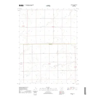
2019 Map of Lindon SW
USGS Topo · Published 2019About this map
High plains prairie and ephemeral watercourses define this stretch of Eastern Colorado along the border of Washington Co and Lincoln Co. The landscape is dominated by the vast grid of the Public Land Survey System, where section lines are traced by a network of county roads including Co Hwy 109 and Co Rd 35. Central to the northern portion is Glen Cem, a lone marker of local heritage situated near Gordon Cr. In the southern half, the terrain becomes more varied as it descends toward the North Fork Arikaree River, which meanders through the plains. This 2019 survey documents the enduring agricultural structure of the region, showing how contemporary infrastructure like Co Rd 0 follows historical boundaries established over a century ago.
Find a feature on this map
21 named features on this map. Tap any name to fly to it.
Don’t see what you’re looking for? This feature index may not catch every label — zoom into the map to look around manually.
Map Details
Editions of this 2019 Lindon SW Map
This is the sole edition of this map. No revisions or reprints were ever made.
Other maps of this area

1891 · Limon
USGS Topo · 1:125,000

1892 · Limon
USGS Topo · 1:125,000

1954 · Limon
USGS Topo · 1:250,000

1957 · Limon
USGS Topo · 1:250,000

1958 · Limon
USGS Topo · 1:250,000

1973 · Lindon NE
USGS Topo · 1:24,000

1973 · Lusto Springs
USGS Topo · 1:24,000

1973 · Lindon SW
USGS Topo · 1:24,000

1973 · Lindon
USGS Topo · 1:24,000

1973 · Last Chance
USGS Topo · 1:24,000