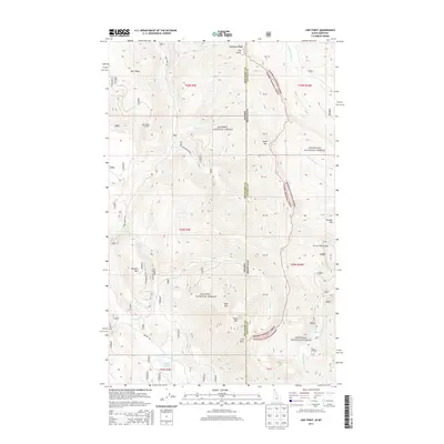
2013 Map of Line Point
USGS Topo · Published 2013About this map
Kanisku National Forest and Kootenai National Forest converge at the shared border of Idaho and Montana, creating a high-altitude landscape defined by steep ridges and alpine waters. This 2013 survey documents a remote wilderness environment where peaks such as Solomon Mtn and Keno Mtn rise above the drainage basins of Mill Cr and Solomon Cr. A network of forest access routes, including Solomon Lake Rd and Perkins Rd, provide the only terrestrial links to small bodies of water like Solomon Lake and Perkins Lake. The presence of the Deer Ridge Lookout on the western edge of the quadrangle suggests the area's ongoing importance for fire surveillance and forest management. Significant topographic features like Buckhorn Ridge and Deer Ridge provide a natural frame for the international and interstate boundary lines that bisect this mountain terrain.
Find a feature on this map
36 named features on this map. Tap any name to fly to it.
Don’t see what you’re looking for? This feature index may not catch every label — zoom into the map to look around manually.
Map Details
Editions of this 2013 Line Point Map
This is the sole edition of this map. No revisions or reprints were ever made.
Other maps of this area

1911 · Priest Lake
USGS Topo · 1:250,000

1913 · Priest Lake
USGS Topo · 1:250,000

1957 · Kalispell
USGS Topo · 1:250,000

1958 · Sandpoint
USGS Topo · 1:250,000

1960 · Kalispell
USGS Topo · 1:250,000

1961 · Kalispell
USGS Topo · 1:250,000

1963 · Sandpoint
USGS Topo · 1:250,000

1963 · Mount Baldy
USGS Topo · 1:24,000

1963 · Northwest Peak
USGS Topo · 1:24,000
1963 · Newton Mountain
USGS Topo · 1:24,000