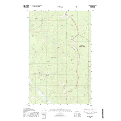
2020 Map of Line Point
USGS Topo · Published 2020About this map
The Idaho and Montana state line bisects this remote mountain landscape, where the Kootenai and Kaniksu National Forests meet. High-elevation peaks such as Goat Mtn, Reno Mtn, and Thunder Mtn define the drainage basins for numerous creeks, including the headwaters of Hellroaring Creek and N Fork Meadow Creek. The geography here is marked by prominent ridges like Buckhorn Ridge and Keno Ridge, which separate the various sub-basins of the Purcell Mountains.
Find a feature on this map
51 named features on this map. Tap any name to fly to it.
Don’t see what you’re looking for? This feature index may not catch every label — zoom into the map to look around manually.
Map Details
Editions of this 2020 Line Point Map
This is the sole edition of this map. No revisions or reprints were ever made.
Other maps of this area

1911 · Priest Lake
USGS Topo · 1:250,000

1913 · Priest Lake
USGS Topo · 1:250,000

1957 · Kalispell
USGS Topo · 1:250,000

1958 · Sandpoint
USGS Topo · 1:250,000

1960 · Kalispell
USGS Topo · 1:250,000

1961 · Kalispell
USGS Topo · 1:250,000

1963 · Sandpoint
USGS Topo · 1:250,000

1963 · Mount Baldy
USGS Topo · 1:24,000

1963 · Northwest Peak
USGS Topo · 1:24,000
1963 · Newton Mountain
USGS Topo · 1:24,000