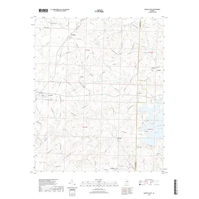
2018 Map of Lineville East
USGS Topo · Published 2018About this map
Lineville serves as the western anchor of this East Central Alabama landscape, where the terrain slopes toward the expansive R L Harris Reservoir on the eastern boundary. The map captures a high density of rural burial sites, highlighting the importance of family and community lineage in the region. Notable locations include the Old Pleasant Grove Cem and Shiloh Cem, which stand alongside smaller settlements like Barfield, Berwick, and Cragford.
Find a feature on this map
104 named features on this map. Tap any name to fly to it.
Don’t see what you’re looking for? This feature index may not catch every label — zoom into the map to look around manually.
Map Details
Editions of this 2018 Lineville East Map
This is the sole edition of this map. No revisions or reprints were ever made.
Other maps of this area

1891 · Ashland
USGS Topo · 1:125,000

1953 · Atlanta
USGS Topo · 1:250,000

1957 · Atlanta
USGS Topo · 1:250,000

1958 · Atlanta
USGS Topo · 1:250,000

1969 · Wadley North
USGS Topo · 1:24,000

1969 · Gibsonville
USGS Topo · 1:24,000

1969 · Mellow Valley
USGS Topo · 1:24,000
1969 · Cheaha Mountain
USGS Topo · 1:24,000
1969 · Lineville West
USGS Topo · 1:24,000
1970 · Delta
USGS Topo · 1:24,000