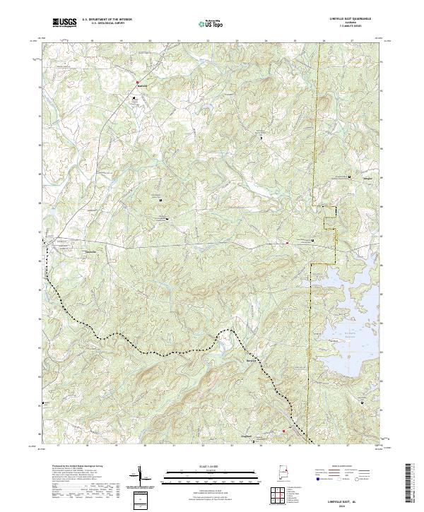
2024 Map of Lineville East
USGS Topo · Published 2024About this map
The town of Lineville and the surrounding rural landscape near the boundary of Clay Co and Randolph Co are depicted here, showing a community defined by its watercourses and small settlements. To the southeast, the R L Harris Reservoir dominates the drainage of Crooked Creek, a major tributary in this region. This area is characterized by numerous country churches and cemeteries that serve as anchors for local genealogy, including the Old Pleasant Grove Church Cem and the Dinglers Chapel Christian Church Cem near Dingler. Small unincorporated communities like Barfield, Berwick, and Cragford are interconnected by a network of rural roads such as Blakes Ferry Rd and Cragford Rd, tracing the early paths of commerce and transit through the hills and valleys of eastern Alabama.
Find a feature on this map
122 named features on this map. Tap any name to fly to it.
Don’t see what you’re looking for? This feature index may not catch every label — zoom into the map to look around manually.
Map Details
Editions of this 2024 Lineville East Map
This is the sole edition of this map. No revisions or reprints were ever made.
Other maps of this area

1891 · Ashland
USGS Topo · 1:125,000

1953 · Atlanta
USGS Topo · 1:250,000

1957 · Atlanta
USGS Topo · 1:250,000

1958 · Atlanta
USGS Topo · 1:250,000

1969 · Wadley North
USGS Topo · 1:24,000

1969 · Gibsonville
USGS Topo · 1:24,000

1969 · Mellow Valley
USGS Topo · 1:24,000
1969 · Cheaha Mountain
USGS Topo · 1:24,000
1969 · Lineville West
USGS Topo · 1:24,000
1970 · Delta
USGS Topo · 1:24,000