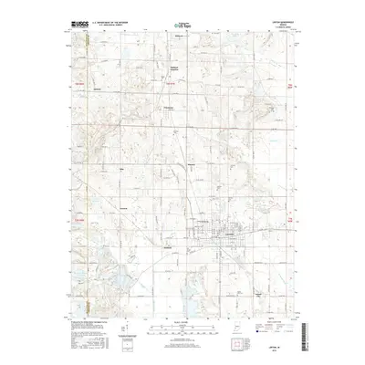
2016 Map of Linton
USGS Topo · Published 2016About this map
Linton serves as the primary hub of this 2016 survey, where the grid of city streets transitions into the complex drainage patterns of Greene and Sullivan counties. The landscape is heavily marked by water-management features and small settlements like Vicksburg, Midland, and Island City. The presence of numerous burial grounds, including the Old Linton Cem and German Cem, provides a map for genealogists tracing local families across this part of the Indiana coal region. The terrain is defined by a series of named water bodies such as County Line Lake, Harmons Lake, and Willow Slough, which interact with agricultural drainage ditches like Beehunter Ditch. These features, alongside the rail-associated Midland Junction, illustrate the historical development of a landscape shaped by both industry and the management of the West Fork White River watershed.
Find a feature on this map
85 named features on this map. Tap any name to fly to it.
Don’t see what you’re looking for? This feature index may not catch every label — zoom into the map to look around manually.
Map Details
Editions of this 2016 Linton Map
This is the sole edition of this map. No revisions or reprints were ever made.
Other maps of this area

1938 · Coal City
USGS Topo · 1:24,000

1938 · Switz City
USGS Topo · 1:24,000

1940 · Linton
USGS Topo · 1:24,000

1940 · Jasonville
USGS Topo · 1:24,000

1943 · Lyons
USGS Topo · 1:24,000

1943 · Hymera
USGS Topo · 1:24,000

1943 · Sandborn
USGS Topo · 1:24,000

1943 · Dugger
USGS Topo · 1:24,000

1944 · Bucktown
USGS Topo · 1:24,000

1947 · Switz City
USGS Topo · 1:24,000