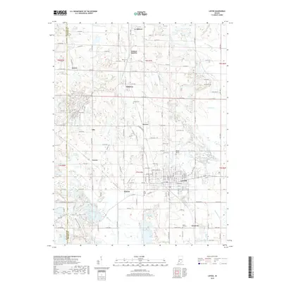
2019 Map of Linton
USGS Topo · Published 2019About this map
Linton serves as the primary hub of this landscape, situated along the Phil Harris Pkwy in southwestern Indiana. The terrain transition is marked by the Hoosier Hills, where numerous small settlements like Vicksburg, Midland, and Island City dot the countryside. For genealogists, the map is a significant record of local burial sites, featuring the German Memory Hill Cem, Old Linton Cem, and Terhune Cem among others.
Find a feature on this map
57 named features on this map. Tap any name to fly to it.
Don’t see what you’re looking for? This feature index may not catch every label — zoom into the map to look around manually.
Map Details
Editions of this 2019 Linton Map
This is the sole edition of this map. No revisions or reprints were ever made.
Other maps of this area

1938 · Coal City
USGS Topo · 1:24,000

1938 · Switz City
USGS Topo · 1:24,000

1940 · Linton
USGS Topo · 1:24,000

1940 · Jasonville
USGS Topo · 1:24,000

1943 · Lyons
USGS Topo · 1:24,000

1943 · Hymera
USGS Topo · 1:24,000

1943 · Sandborn
USGS Topo · 1:24,000

1943 · Dugger
USGS Topo · 1:24,000

1944 · Bucktown
USGS Topo · 1:24,000

1947 · Switz City
USGS Topo · 1:24,000