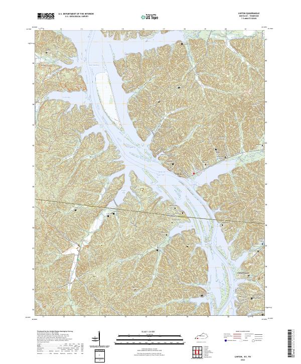
2022 Map of Linton
USGS Topo · Published 2022About this map
Linton, Kentucky, and the riverside settlement of Tobaccoport, Tennessee, anchor this borderland survey along the eastern shores of Lake Barkley. The landscape is defined by the drowned valleys of the Cumberland River system, where massive inlets like Fords Bay, Pryor Bay, and Crockett Bay push deep into the wooded ridges of Fox Ridge and Williams Hollow. This area reflects a significant transition from early river-based commerce to modern recreation and conservation, notably marked by The Trace running through the western portion of the map.
Find a feature on this map
106 named features on this map. Tap any name to fly to it.
Don’t see what you’re looking for? This feature index may not catch every label — zoom into the map to look around manually.
Map Details
Editions of this 2022 Linton Map
This is the sole edition of this map. No revisions or reprints were ever made.
Other maps of this area

1936 · Tharpe
USGS Topo · 1:24,000

1936 · Hamlin
USGS Topo · 1:24,000

1936 · Fenton
USGS Topo · 1:24,000

1936 · Golden Pond
USGS Topo · 1:48,000

1936 · Rushing
USGS Topo · 1:24,000

1950 · Rushing Creek
USGS Topo · 1:24,000
1950 · Fenton
USGS Topo · 1:24,000
1950 · Hamlin
USGS Topo · 1:24,000

1951 · Model
USGS Topo · 1:24,000

1951 · Johnson Hollow
USGS Topo · 1:24,000