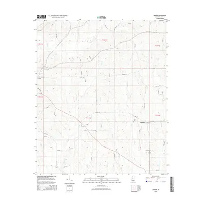
2015 Map of Linwood
USGS Topo · Published 2015About this map
Evans and the surrounding Yazoo County countryside are defined by a network of creeks and rural family landmarks. The landscape is carved by waterways like Piney Cr, Cypress Cr, and Pickett Cr, which drain the varied topography. Genealogists will find a high concentration of family-named burial sites across the township lines, including Pickett Cem, Luce Cem, Hicks Cem, and the Mount Zion Cem near the settlement of Linwood.
Find a feature on this map
63 named features on this map. Tap any name to fly to it.
Don’t see what you’re looking for? This feature index may not catch every label — zoom into the map to look around manually.
Map Details
Editions of this 2015 Linwood Map
This is the sole edition of this map. No revisions or reprints were ever made.
Other maps of this area

1955 · Jackson
USGS Topo · 1:250,000

1961 · Jackson
USGS Topo · 1:250,000

1961 · Canton
USGS Topo · 1:62,500

1961 · Valley
USGS Topo · 1:62,500

1962 · Jackson
USGS Topo · 1:250,000

1962 · Flora
USGS Topo · 1:62,500
1964 · Zeiglerville
USGS Topo · 1:24,000
1964 · Ebenezer
USGS Topo · 1:24,000

1964 · Linwood
USGS Topo · 1:24,000

1964 · Vaughan
USGS Topo · 1:24,000