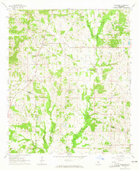
1964 Map of Ebenezer
USGS Topo · Published 1965About this map
The unincorporated community of Ebenezer serves as the focal point for this mid-century survey of the Mississippi interior. Situated along the border of Holmes Co and Yazoo Co, the landscape is defined by the winding paths of Big Cypress Creek and Dry Creek. The area's social fabric is clearly visible through a high concentration of country churches and family burial grounds, suggesting a deeply rooted rural society. Names like St Peters Rock Ch, Holy City Ch, and New Canaan Ch dot the landscape alongside the Salem Sch. This map documents a traditional Southern agricultural pattern of dispersed settlements and small congregational centers just before modern consolidated development began to alter the character of the region.
Find a feature on this map
21 named features on this map. Tap any name to fly to it.
Don’t see what you’re looking for? This feature index may not catch every label — zoom into the map to look around manually.
Map Details
Editions of this 1964 Ebenezer Map
This is the sole edition of this map. No revisions or reprints were ever made.
Other maps of this area

1940 · Lexington
USGS Topo · 1:62,500

1953 · Meridian
USGS Topo · 1:250,000

1953 · Greenwood
USGS Topo · 1:250,000

1953 · West Point
USGS Topo · 1:250,000

1955 · Jackson
USGS Topo · 1:250,000

1956 · Greenwood
USGS Topo · 1:250,000

1957 · Meridian
USGS Topo · 1:250,000

1957 · Lexington
USGS Topo · 1:62,500

1958 · West Point
USGS Topo · 1:250,000

1958 · Lexington
USGS Topo · 1:62,500