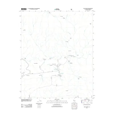
2012 Map of Lion Canyon
USGS Topo · Published 2012About this map
Rose Valley and its surrounding canyonlands appear here in high detail, centered on a landscape defined by the drainage of Sespe Cr and its numerous tributaries. The map documents a blend of backcountry infrastructure and private holdings, including Circle B Ranch, Gore Ranch, and the Rancho Grande complex along Rose Valley Rd. These sites are framed by significant topographical markers like Chief Peak to the south and Nordhoff Ridge to the west.
Find a feature on this map
38 named features on this map. Tap any name to fly to it.
Don’t see what you’re looking for? This feature index may not catch every label — zoom into the map to look around manually.
Map Details
Editions of this 2012 Lion Canyon Map
This is the sole edition of this map. No revisions or reprints were ever made.
Other maps of this area

1903 · Santa Paula
USGS Topo · 1:62,500

1903 · Mt. Pinos
USGS Topo · 1:125,000

1904 · Ventura
USGS Topo · 1:62,500

1941 · Ventura
USGS Topo · 1:62,500

1942 · Santa Paula
USGS Topo · 1:62,500

1942 · Wheeler Springs
USGS Topo · 1:24,000

1943 · Topatopa Mountains
USGS Topo · 1:24,000

1943 · San Guillermo
USGS Topo · 1:24,000

1943 · Lockwood Valley
USGS Topo · 1:24,000

1943 · Lion Canyon
USGS Topo · 1:24,000