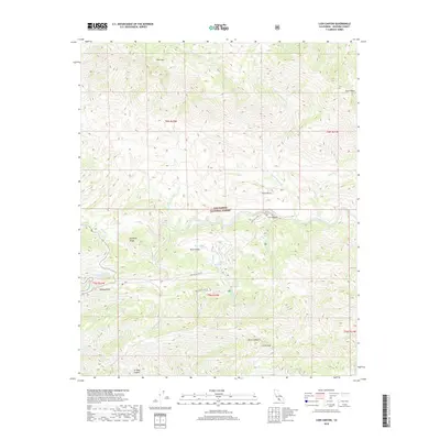
2018 Map of Lion Canyon
USGS Topo · Published 2018About this map
Rose Valley sits as a central basin within the protected lands of the Los Padres National Forest, where the high elevations of Pine Mtn and Thorn Point define the northern horizon. This 2018 survey captures a landscape shaped by drainage networks, where Sespe Cr and its numerous tributaries like Piedra Blanca Cr and Rose Valley Cr carve through the steep topography. The presence of Upper Rose Lake and Lower Rose Lake near the Rose Valley Rd corridor indicates a pocket of water resources and recreational interest amidst the higher peaks. Distinctive geological markers such as Piedra Blanca and the sharp elevation at Chief Peak provide clear landmarks for navigating this section of Ventura County, while Rose Valley Falls serves as a notable hydrologic feature in the south-central portion of the quadrangle.
Find a feature on this map
30 named features on this map. Tap any name to fly to it.
Don’t see what you’re looking for? This feature index may not catch every label — zoom into the map to look around manually.
Map Details
Editions of this 2018 Lion Canyon Map
This is the sole edition of this map. No revisions or reprints were ever made.
Other maps of this area

1903 · Santa Paula
USGS Topo · 1:62,500

1903 · Mt. Pinos
USGS Topo · 1:125,000

1904 · Ventura
USGS Topo · 1:62,500

1941 · Ventura
USGS Topo · 1:62,500

1942 · Santa Paula
USGS Topo · 1:62,500

1942 · Wheeler Springs
USGS Topo · 1:24,000

1943 · Topatopa Mountains
USGS Topo · 1:24,000

1943 · San Guillermo
USGS Topo · 1:24,000

1943 · Lockwood Valley
USGS Topo · 1:24,000

1943 · Lion Canyon
USGS Topo · 1:24,000