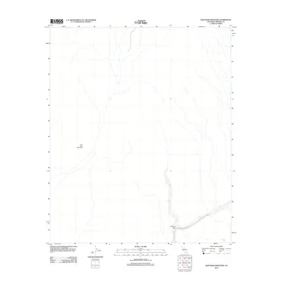
2012 Map of Lion Head Mountain
USGS Topo · Published 2012About this map
Lion Head Mountain anchors this arid landscape in Imperial County, defining the topography of a region marked by deep drainage patterns and seasonal water scarcity. The map illustrates the minimal human imprint on this desert terrain in the early 21st century, where survival and transit are tied to the few named points of interest. One such critical resource is Salvation Spring, located in the southeastern corner, serving as a rare hydrological marker. Access through this environment is primarily facilitated by the Milano-Pegleg Well Rd, which cuts across the southern portion of the quadrangle. This 2012 survey captures the relationship between natural landmarks and the limited infrastructure required to navigate the Imperial County backcountry.
Find a feature on this map
3 named features on this map. Tap any name to fly to it.
Don’t see what you’re looking for? This feature index may not catch every label — zoom into the map to look around manually.
Map Details
Editions of this 2012 Lion Head Mountain Map
This is the sole edition of this map. No revisions or reprints were ever made.
Other maps of this area

1940 · Iris
USGS Topo · 1:62,500

1940 · Iris Pass
USGS Topo · 1:62,500

1945 · Iris Pass
USGS Topo · 1:62,500

1945 · Iris
USGS Topo · 1:62,500

1953 · Chuckwalla Spring
USGS Topo · 1:62,500

1953 · Acolita
USGS Topo · 1:62,500

1954 · Salton Sea
USGS Topo · 1:250,000

1955 · Tortuga
USGS Topo · 1:24,000

1955 · Salton Sea
USGS Topo · 1:250,000
1956 · Iris
USGS Topo · 1:24,000