
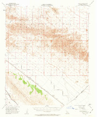
1953 Map of Acolita
USGS Topo · Published 1955About this map
The Chocolate Mountains dominate the landscape of this mid-century survey, defining a region of intense topography and military utility. Rising above the desert floor, peaks like Blue Mountain oversee the Aerial Gunnery Range and a wide Naval Reservation, marking a period when vast stretches of the California desert were designated for defense training. Below the mountain slopes, the Southern Pacific Road provides the primary infrastructure link, connecting the small railway settlements of Acolita and Mesquite. These outposts represent the sparse industrial and transit footprint of the era, supported by the modern engineering of the Coachella Canal cutting across the East Mesa. Mining interests remain evident in the high country, where the Black Eagle Mine and Mary Lode Mine suggest the persistent search for mineral wealth amidst the Mammoth Wash drainage systems.
Find a feature on this map
15 named features on this map. Tap any name to fly to it.
Don’t see what you’re looking for? This feature index may not catch every label — zoom into the map to look around manually.
Map Details
Editions of this 1953 Acolita Map
5 editions found
Other maps of this area

1903 · Yuma
USGS Topo · 1:125,000

1905 · Yuma
USGS Topo · 1:125,000

1907 · Holtville
USGS Topo · 1:125,000

1940 · Iris
USGS Topo · 1:62,500

1940 · Iris Pass
USGS Topo · 1:62,500

1940 · Alamorio
USGS Topo · 1:62,500

1942 · El Centro
USGS Topo · 1:250,000

1942 · Yuma
USGS Topo · 1:250,000

1942 · Blythe
USGS Topo · 1:250,000

1945 · Alamorio
USGS Topo · 1:62,500