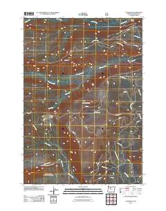
2011 Map of Lionshead
USGS Topo · Published 2011About this map
Lionshead and Bald Peter anchor this high-elevation landscape in Jefferson County, where the terrain is defined by a dense network of drainage systems and ridge-running Bureau of Indian Affairs routes. The drainage pattern is complex, with the Whitewater River and Shitike Creek serving as primary arteries for numerous tributaries like Lionshead Creek, Milk Creek, and Racing Creek. These waterways carve through the terrain between prominent heights such as Camp Creek Butte and Biddle Pass.
Find a feature on this map
38 named features on this map. Tap any name to fly to it.
Don’t see what you’re looking for? This feature index may not catch every label — zoom into the map to look around manually.
Map Details
Editions of this 2011 Lionshead Map
This is the sole edition of this map. No revisions or reprints were ever made.
Other maps of this area

1927 · Mt. Jefferson
USGS Topo · 1:125,000

1930 · Mt. Jefferson
USGS Topo · 1:125,000

1955 · Bend
USGS Topo · 1:250,000

1957 · Bend
USGS Topo · 1:250,000

1958 · Bend
USGS Topo · 1:250,000

1961 · Whitewater River
USGS Topo · 1:62,500

1961 · Fort Butte
USGS Topo · 1:62,500
1961 · Mt. Jefferson
USGS Topo · 1:62,500
1961 · Breitenbush Hot Springs
USGS Topo · 1:62,500
1983 · Madras
USGS Topo · 1:100,000