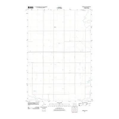
2011 Map of Lisbon NE
USGS Topo · Published 2011About this map
The Sheyenne River winds through the southeastern and northeastern corners of this landscape, carving a natural path through the otherwise structured agricultural grid of Ransom County. The terrain is defined by a meticulous section-line road network, including thoroughfares such as 135th Ave SE and 70th St SE, which facilitate access to the surrounding farmsteads. Two significant local landmarks provide vital links to the area's social history and genealogy: Trinity Cemetery in the northeast and Saint Paul Cemetery located more centrally. These sites, along with the numerous small wetlands and basins scattered across the prairie, reflect the enduring rural character of North Dakota's eastern plains in the early 21st century.
Find a feature on this map
15 named features on this map. Tap any name to fly to it.
Don’t see what you’re looking for? This feature index may not catch every label — zoom into the map to look around manually.
Map Details
Editions of this 2011 Lisbon NE Map
This is the sole edition of this map. No revisions or reprints were ever made.
Other maps of this area

1895 · Casselton
USGS Topo · 1:125,000

1897 · Tower
USGS Topo · 1:125,000

1897 · Casselton
USGS Topo · 1:125,000

1907 · Wyndmere
USGS Topo · 1:125,000

1953 · Fargo
USGS Topo · 1:250,000

1956 · Fargo
USGS Topo · 1:250,000

1960 · Lisbon SE
USGS Topo · 1:24,000

1960 · Lisbon NE
USGS Topo · 1:24,000

1960 · Enderlin South
USGS Topo · 1:24,000

1960 · Venlo
USGS Topo · 1:24,000