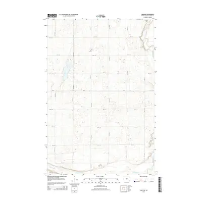
2014 Map of Lisbon NE
USGS Topo · Published 2014About this map
The Sheyenne River defines the eastern and southern edges of this Ransom County landscape, its meandering channel cutting through the prairie north of Lisbon. This 2014 survey reveals a strictly maintained section-line grid of rural roads, including 134th Ave SE and 72nd St SE, which partition the agricultural terrain into precise geometric blocks. Two rural burial grounds, Saint Paul Cem and Trinity Cem, serve as the primary markers of the area's local history and community roots. Bisecting the map horizontally, ND-27 provides the main east-west transit through Casey Township, illustrating the modern infrastructure that connects these quiet rural homesteads and farming operations to the larger regional trade centers.
Find a feature on this map
18 named features on this map. Tap any name to fly to it.
Don’t see what you’re looking for? This feature index may not catch every label — zoom into the map to look around manually.
Map Details
Editions of this 2014 Lisbon NE Map
This is the sole edition of this map. No revisions or reprints were ever made.
Other maps of this area

1895 · Casselton
USGS Topo · 1:125,000

1897 · Tower
USGS Topo · 1:125,000

1897 · Casselton
USGS Topo · 1:125,000

1907 · Wyndmere
USGS Topo · 1:125,000

1953 · Fargo
USGS Topo · 1:250,000

1956 · Fargo
USGS Topo · 1:250,000

1960 · Lisbon SE
USGS Topo · 1:24,000

1960 · Lisbon NE
USGS Topo · 1:24,000

1960 · Enderlin South
USGS Topo · 1:24,000

1960 · Venlo
USGS Topo · 1:24,000