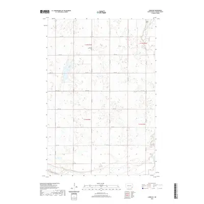
2020 Map of Lisbon NE
USGS Topo · Published 2020About this map
The Sheyenne River winds through the northeast and southwest corners of this prairie landscape, defining the topography of Ransom County. The terrain is characterized by numerous small depressions and wetlands typical of this region's glacial geography, framed by a rigid grid of section roads including 64th St SE and 137th Ave SE. For those researching local Lutheran heritage, the map provides precise locations for two distinct burial grounds: the Anselm Lutheran Cem in the north and the Saint Paul Lutheran Cem further south. These sites, along with the detailed Public Land Survey System boundaries such as t135n r55w, offer a clear view of the rural settlement patterns and historical land divisions in North Dakota.
Find a feature on this map
22 named features on this map. Tap any name to fly to it.
Don’t see what you’re looking for? This feature index may not catch every label — zoom into the map to look around manually.
Map Details
Editions of this 2020 Lisbon NE Map
This is the sole edition of this map. No revisions or reprints were ever made.
Other maps of this area

1895 · Casselton
USGS Topo · 1:125,000

1897 · Tower
USGS Topo · 1:125,000

1897 · Casselton
USGS Topo · 1:125,000

1907 · Wyndmere
USGS Topo · 1:125,000

1953 · Fargo
USGS Topo · 1:250,000

1956 · Fargo
USGS Topo · 1:250,000

1960 · Lisbon SE
USGS Topo · 1:24,000

1960 · Lisbon NE
USGS Topo · 1:24,000

1960 · Enderlin South
USGS Topo · 1:24,000

1960 · Venlo
USGS Topo · 1:24,000