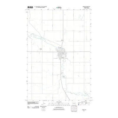
2011 Map of Lisbon
USGS Topo · Published 2011About this map
The Sheyenne River winds through the heart of Lisbon, defining the town’s layout and character at the start of the 21st century. The river's flow is punctuated by the Lisbon Dam and the Soldiers Home Dam, which reflect the community's long-standing relationship with its water resources. The street grid of the town center is meticulously detailed, showing the layout from Jackson Ave E to the residential drives near the water's edge.
Find a feature on this map
46 named features on this map. Tap any name to fly to it.
Don’t see what you’re looking for? This feature index may not catch every label — zoom into the map to look around manually.
Map Details
Editions of this 2011 Lisbon Map
This is the sole edition of this map. No revisions or reprints were ever made.
Other maps of this area

1897 · Tower
USGS Topo · 1:125,000

1953 · Fargo
USGS Topo · 1:250,000

1956 · Fargo
USGS Topo · 1:250,000

1957 · Elliott SE
USGS Topo · 1:24,000

1960 · Lisbon SE
USGS Topo · 1:24,000

1960 · Lisbon NE
USGS Topo · 1:24,000

1960 · Enderlin South
USGS Topo · 1:24,000

1962 · Lisbon
USGS Topo · 1:24,000

1962 · Lisbon SW
USGS Topo · 1:24,000

1962 · Elliott
USGS Topo · 1:24,000