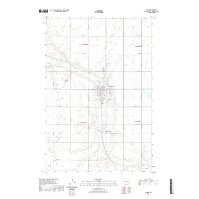
2020 Map of Lisbon
USGS Topo · Published 2020About this map
The Sheyenne River winds through the heart of Lisbon, North Dakota, shaping the settlement patterns of this Ransom County community as it appeared in 2020. This contemporary topographic record details the residential grid of the city, showing thoroughfares such as Main St, Ash St, and Rose St alongside the commercial and civic development north of the river bend. The landscape transition from the river valley to the surrounding agricultural uplands is marked by the presence of Timber Coulee to the southeast and the Lisbon Municipal Airport to the northwest. For those tracing family histories or local land use, the map provides precise locations for Oakwood Cem and Saint Aloysius Catholic Cem, situated on the northern outskirts, reflecting the long-established community structure of the region.
Find a feature on this map
47 named features on this map. Tap any name to fly to it.
Don’t see what you’re looking for? This feature index may not catch every label — zoom into the map to look around manually.
Map Details
Editions of this 2020 Lisbon Map
This is the sole edition of this map. No revisions or reprints were ever made.
Other maps of this area

1897 · Tower
USGS Topo · 1:125,000

1953 · Fargo
USGS Topo · 1:250,000

1956 · Fargo
USGS Topo · 1:250,000

1957 · Elliott SE
USGS Topo · 1:24,000

1960 · Lisbon SE
USGS Topo · 1:24,000

1960 · Lisbon NE
USGS Topo · 1:24,000

1960 · Enderlin South
USGS Topo · 1:24,000

1962 · Lisbon
USGS Topo · 1:24,000

1962 · Lisbon SW
USGS Topo · 1:24,000

1962 · Elliott
USGS Topo · 1:24,000