
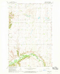
1962 Map of Lisbon
USGS Topo · Published 1964About this map
The Sheyenne River snakes through the center of this Ransom County landscape, creating dramatic loops at Big Bend and Island Park during the early 1960s. The town of Lisbon serves as the primary hub, situated where the Northern Pacific railroad corridor meets the river's edge. This map reveals a community structured around civic and recreational landmarks, including the State Soldiers Home on the southern edge of town and the County Fairground to the west.
Find a feature on this map
18 named features on this map. Tap any name to fly to it.
Don’t see what you’re looking for? This feature index may not catch every label — zoom into the map to look around manually.
Map Details
Editions of this 1962 Lisbon Map
This is the sole edition of this map. No revisions or reprints were ever made.
Other maps of this area

1897 · Tower
USGS Topo · 1:125,000

1953 · Fargo
USGS Topo · 1:250,000

1956 · Fargo
USGS Topo · 1:250,000

1957 · Elliott SE
USGS Topo · 1:24,000

1960 · Lisbon SE
USGS Topo · 1:24,000

1960 · Lisbon NE
USGS Topo · 1:24,000

1960 · Enderlin South
USGS Topo · 1:24,000

1962 · Lisbon SW
USGS Topo · 1:24,000

1962 · Elliott
USGS Topo · 1:24,000
1967 · Nome SE
USGS Topo · 1:24,000