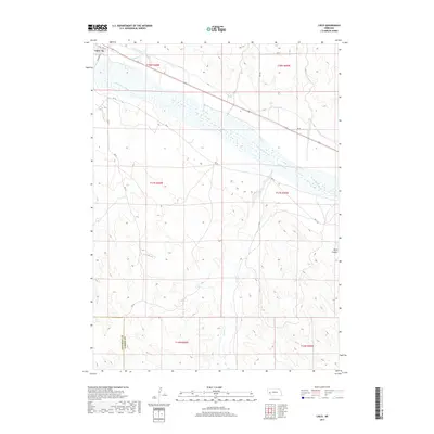
2017 Map of Lisco
USGS Topo · Published 2017About this map
The settlement of Lisco serves as the focal point for this survey of the western Nebraska panhandle, situated along the northern banks of the North Platte River. This landscape is defined by its sophisticated irrigation infrastructure, where the Lisco Canal and N River Canal run parallel to the river's course, channeling water to support the region's agricultural economy. The terrain transitions from the river valley into the broken ground of Wolf Canyon to the east, while the southern portion of the quadrangle is marked by the winding paths of Rush Creek. This survey captures the rural character of the Cheyenne and Garden County border, showing the intersection of local routes like RD 151 and RD 54 that navigate the varied topography between the river basin and the surrounding uplands.
Find a feature on this map
20 named features on this map. Tap any name to fly to it.
Don’t see what you’re looking for? This feature index may not catch every label — zoom into the map to look around manually.
Map Details
Editions of this 2017 Lisco Map
This is the sole edition of this map. No revisions or reprints were ever made.
Other maps of this area

1896 · Browns Creek
USGS Topo · 1:125,000

1899 · Browns Creek
USGS Topo · 1:125,000

1899 · Sidney
USGS Topo · 1:125,000

1900 · Chappell
USGS Topo · 1:125,000

1950 · Crescent Lake
USGS Topo · 1:62,500

1954 · Scottsbluff
USGS Topo · 1:250,000

1958 · Scottsbluff
USGS Topo · 1:250,000

1971 · Oshkosh SW
USGS Topo · 1:24,000

1971 · Coumbe Bluff
USGS Topo · 1:24,000

1971 · Tar Valley SW
USGS Topo · 1:24,000