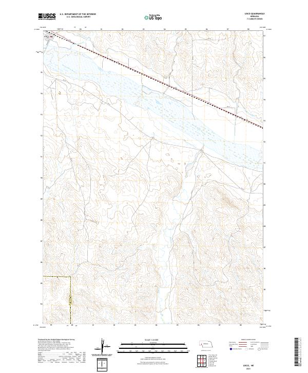
2021 Map of Lisco
USGS Topo · Published 2021About this map
The Lisco settlement anchors this western Nebraska landscape, positioned where the Lisco Canal and Coldwater Cr meet the wide valley of the North Platte River. The mapping reveals a complex network of agricultural irrigation and water management, featuring both the Lisco Canal to the west and the N River Canal further east. These man-made waterways parallel the river, supporting the local economy across the flat bottomlands. To the south, the terrain transitions into more dissected upland country where Rush Creek meanders through the breaks. The southwestern portion of the map identifies the jurisdictional boundary of Cheyenne Co Garden Co, providing a clear record of the intersection between county lines and the local township and range grid system.
Find a feature on this map
20 named features on this map. Tap any name to fly to it.
Don’t see what you’re looking for? This feature index may not catch every label — zoom into the map to look around manually.
Map Details
Editions of this 2021 Lisco Map
This is the sole edition of this map. No revisions or reprints were ever made.
Other maps of this area

1896 · Browns Creek
USGS Topo · 1:125,000

1899 · Browns Creek
USGS Topo · 1:125,000

1899 · Sidney
USGS Topo · 1:125,000

1900 · Chappell
USGS Topo · 1:125,000

1950 · Crescent Lake
USGS Topo · 1:62,500

1954 · Scottsbluff
USGS Topo · 1:250,000

1958 · Scottsbluff
USGS Topo · 1:250,000

1971 · Oshkosh SW
USGS Topo · 1:24,000

1971 · Coumbe Bluff
USGS Topo · 1:24,000

1971 · Tar Valley SW
USGS Topo · 1:24,000