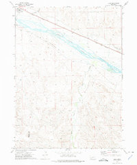
1972 Map of Lisco
USGS Topo · Published 1975About this map
The braided channels of the North Platte River dominate this Nebraska landscape, where the Union Pacific railroad and the Oregon Trail parallel the water's path. In the settlement of Lisco, the railroad corridor defines the town's orientation, while the nearby Lisco Memorial Cem provides a point of interest for genealogical research. The map illustrates a shifting relationship with the land through various water management features, including the North River Canal (Abandoned), Rush Creek, and Coldwater Cr. In the southern portion of the survey, the Cheyenne Co Garden Co boundary line crosses the undulating terrain. A local Gravel Pit near the river suggests small-scale industrial activity in this primarily agricultural and transit-oriented corridor during the early 1970s.
Find a feature on this map
10 named features on this map. Tap any name to fly to it.
Don’t see what you’re looking for? This feature index may not catch every label — zoom into the map to look around manually.
Map Details
Editions of this 1972 Lisco Map
This is the sole edition of this map. No revisions or reprints were ever made.
Other maps of this area

1896 · Browns Creek
USGS Topo · 1:125,000

1899 · Browns Creek
USGS Topo · 1:125,000

1899 · Sidney
USGS Topo · 1:125,000

1900 · Chappell
USGS Topo · 1:125,000

1950 · Crescent Lake
USGS Topo · 1:62,500

1954 · Scottsbluff
USGS Topo · 1:250,000

1958 · Scottsbluff
USGS Topo · 1:250,000

1971 · Oshkosh SW
USGS Topo · 1:24,000

1971 · Coumbe Bluff
USGS Topo · 1:24,000

1971 · Tar Valley SW
USGS Topo · 1:24,000