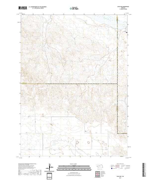
2021 Map of Lisco NW
USGS Topo · Published 2021About this map
The North Platte River winds through the northeastern corner of this Panhandle landscape, where the Belmont Canal branches off to support the region's agricultural irrigation. The terrain is characterized by the convergence of three Nebraska counties—Morrill, Garden, and Cheyenne—marking a jurisdictional crossroads in a region defined by high plains and water management. Located near the map's eastern edge, the Lisco Memorial Cem serves as a primary point of local history and genealogy for the area. The landscape is interconnected by a grid of rural routes including RD 58 and RD 137, illustrating the systematic land divisions of the Public Land Survey System that have shaped this portion of the state for over a century.
Find a feature on this map
24 named features on this map. Tap any name to fly to it.
Don’t see what you’re looking for? This feature index may not catch every label — zoom into the map to look around manually.
Map Details
Editions of this 2021 Lisco NW Map
This is the sole edition of this map. No revisions or reprints were ever made.
Other maps of this area

1896 · Browns Creek
USGS Topo · 1:125,000

1899 · Browns Creek
USGS Topo · 1:125,000

1899 · Sidney
USGS Topo · 1:125,000

1954 · Scottsbluff
USGS Topo · 1:250,000

1958 · Scottsbluff
USGS Topo · 1:250,000

1965 · Broadwater
USGS Topo · 1:24,000

1971 · Tar Valley SW
USGS Topo · 1:24,000
1971 · Buske Ranch
USGS Topo · 1:24,000

1972 · Lisco NW
USGS Topo · 1:24,000
1972 · Fairchild Ranch
USGS Topo · 1:24,000