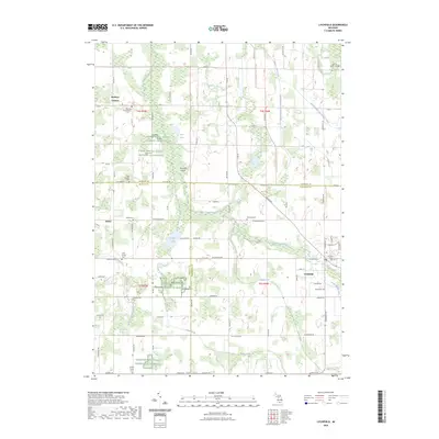
2023 Map of Litchfield
USGS Topo · Published 2023About this map
The Saint Joseph River winds through this rural landscape at the junction of Hillsdale, Branch, and Calhoun counties. The city of Litchfield serves as the primary hub, where industrial developments and the Litchfield Village Cem mark the local geography. Significant portions of the surrounding countryside are managed by the Farm Service Agency Interest of Michigan, indicating a landscape deeply tied to regional agricultural conservation and management.
Find a feature on this map
87 named features on this map. Tap any name to fly to it.
Don’t see what you’re looking for? This feature index may not catch every label — zoom into the map to look around manually.
Map Details
Editions of this 2023 Litchfield Map
This is the sole edition of this map. No revisions or reprints were ever made.
Other maps of this area

1948 · Spring Arbor
USGS Topo · 1:62,500

1948 · Homer
USGS Topo · 1:62,500

1949 · Homer
USGS Topo · 1:62,500

1949 · Spring Arbor
USGS Topo · 1:62,500

1953 · Fort Wayne
USGS Topo · 1:250,000

1956 · Fort Wayne
USGS Topo · 1:250,000

1958 · Grand Rapids
USGS Topo · 1:250,000

1959 · Hillsdale
USGS Topo · 1:24,000

1960 · Coldwater East
USGS Topo · 1:24,000
1960 · Allen
USGS Topo · 1:24,000