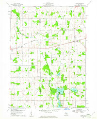
1960 Map of Allen
USGS Topo · Published 1961About this map
Allen and Quincy serve as the primary hubs on this landscape where the New York Central railroad tracks cut across the border of Branch and Hillsdale counties. The area is defined by a dense network of country roads connecting isolated social centers like the Grange Hall and Community Hall, reflecting a mid-century rural economy. To the south, the terrain softens into a cluster of glacial water bodies including Hemlock Lake, Round Lake, and Carpenter Lake, where Camp Seley indicates the early development of recreational spaces near the larger agricultural tracts.
Find a feature on this map
33 named features on this map. Tap any name to fly to it.
Don’t see what you’re looking for? This feature index may not catch every label — zoom into the map to look around manually.
Map Details
Editions of this 1960 Allen Map
3 editions found
Other maps of this area

1948 · Spring Arbor
USGS Topo · 1:62,500

1948 · Homer
USGS Topo · 1:62,500

1949 · Homer
USGS Topo · 1:62,500

1949 · Spring Arbor
USGS Topo · 1:62,500

1953 · Fort Wayne
USGS Topo · 1:250,000

1956 · Fort Wayne
USGS Topo · 1:250,000

1958 · Grand Rapids
USGS Topo · 1:250,000

1959 · Hillsdale
USGS Topo · 1:24,000

1959 · Reading
USGS Topo · 1:24,000

1960 · Coldwater East
USGS Topo · 1:24,000