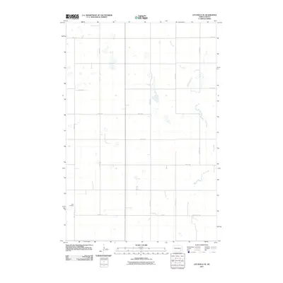
2011 Map of Litchville SE
USGS Topo · Published 2011About this map
Bear Creek meanders through this portion of Ransom County, carving a winding path through a landscape defined by the rigid grid of the Public Land Survey System. The area is dominated by agricultural sections, with long-established section-line roads like 111th Ave SE and 55th St SE providing the primary framework for movement across the plains. A significant local landmark for genealogists and family historians is the Sjulli Cemetery, situated along 110th Ave SE in the southwestern quadrant. This 2011 survey reflects the enduring rural character of Northland Township, where the intersection of natural drainage and man-made boundaries creates a patchwork of wetlands and prairie fields. Modern infrastructure, including County Rd 129, links this quiet corner of North Dakota to the broader regional network while preserving the isolation of its family-named landmarks.
Find a feature on this map
16 named features on this map. Tap any name to fly to it.
Don’t see what you’re looking for? This feature index may not catch every label — zoom into the map to look around manually.
Map Details
Editions of this 2011 Litchville SE Map
This is the sole edition of this map. No revisions or reprints were ever made.
Other maps of this area

1895 · Lamoure
USGS Topo · 1:125,000

1897 · Tower
USGS Topo · 1:125,000

1897 · Eckelson
USGS Topo · 1:125,000

1918 · La Moure
USGS Topo · 1:125,000

1953 · Jamestown
USGS Topo · 1:250,000

1953 · Fargo
USGS Topo · 1:250,000

1956 · Fargo
USGS Topo · 1:250,000

1956 · Jamestown
USGS Topo · 1:250,000
1962 · Englevale
USGS Topo · 1:24,000

1967 · Ft. Ransom
USGS Topo · 1:24,000
Featured Places
- Northland Township, ND
- Fort Ransom Township, ND
- Black Loam Township, ND
- Litchville Township, ND
- LaMoure County, ND