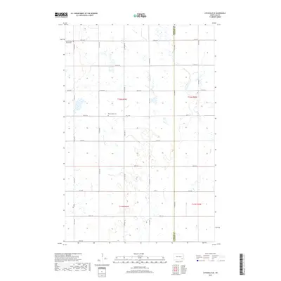
2018 Map of Litchville SE
USGS Topo · Published 2018About this map
The borderlands of Lamoure Co and Ransom Co are defined by a grid of prairie roads and the winding course of Bear Cr. This landscape in the Northland Township area preserves several sites of significance to local genealogy and pioneer history. Two burial grounds, North Lamoure Pioneer Cem and a second North Lamoure cem, are situated in the northern sections of the map, while Sjulli Cem lies further south. The terrain is characterized by numerous small depressions and wetlands typical of this region, intersected by a systematic road network including Co Rd 35 and many numbered section-line avenues. These early 21st-century records show how the original Public Land Survey System continues to dictate the modern rural layout of these North Dakota townships.
Find a feature on this map
25 named features on this map. Tap any name to fly to it.
Don’t see what you’re looking for? This feature index may not catch every label — zoom into the map to look around manually.
Map Details
Editions of this 2018 Litchville SE Map
This is the sole edition of this map. No revisions or reprints were ever made.
Other maps of this area

1895 · Lamoure
USGS Topo · 1:125,000

1897 · Tower
USGS Topo · 1:125,000

1897 · Eckelson
USGS Topo · 1:125,000

1918 · La Moure
USGS Topo · 1:125,000

1953 · Jamestown
USGS Topo · 1:250,000

1953 · Fargo
USGS Topo · 1:250,000

1956 · Fargo
USGS Topo · 1:250,000

1956 · Jamestown
USGS Topo · 1:250,000
1962 · Englevale
USGS Topo · 1:24,000

1967 · Ft. Ransom
USGS Topo · 1:24,000
Featured Places
- Northland Township, ND
- Fort Ransom Township, ND
- Black Loam Township, ND
- Litchville Township, ND
- LaMoure County, ND