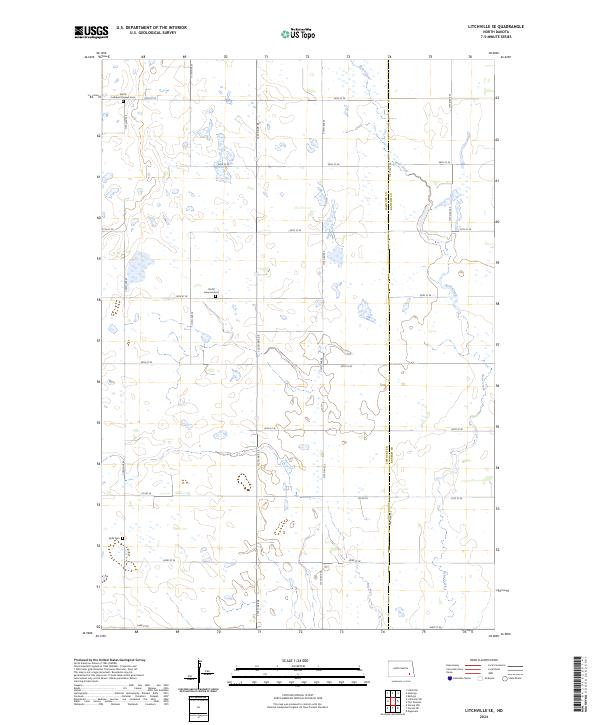
2024 Map of Litchville SE
USGS Topo · Published 2024About this map
Bear Creek meanders through the prairie landscape of this southeastern North Dakota quadrangle, marking the boundary between LaMoure and Ransom counties. This 2024 survey details a rural township pattern defined by section roads like 55th St SE and Co Rd 35. The presence of several historic burial sites, including the North Lamoure Pioneer Cem, North Lamoure Cem, and Sjulli Cem, offers specific points of interest for genealogists researching the early Norwegian and European settlement families of the Sheyenne River valley region. Large protected wetlands, specifically the LaMoure County Waterfowl Production Area and Ransom County Waterfowl Production Area, indicate the area's importance to the migratory bird habitats of the Prairie Pothole region, where small seasonal pools dot the agricultural grid.
Find a feature on this map
21 named features on this map. Tap any name to fly to it.
Don’t see what you’re looking for? This feature index may not catch every label — zoom into the map to look around manually.
Map Details
Editions of this 2024 Litchville SE Map
This is the sole edition of this map. No revisions or reprints were ever made.
Other maps of this area

1895 · Lamoure
USGS Topo · 1:125,000

1897 · Tower
USGS Topo · 1:125,000

1897 · Eckelson
USGS Topo · 1:125,000

1918 · La Moure
USGS Topo · 1:125,000

1953 · Jamestown
USGS Topo · 1:250,000

1953 · Fargo
USGS Topo · 1:250,000

1956 · Fargo
USGS Topo · 1:250,000

1956 · Jamestown
USGS Topo · 1:250,000
1962 · Englevale
USGS Topo · 1:24,000

1967 · Ft. Ransom
USGS Topo · 1:24,000
Featured Places
- Litchville Township, ND
- Northland Township, ND
- Fort Ransom Township, ND
- Black Loam Township, ND
- LaMoure County, ND