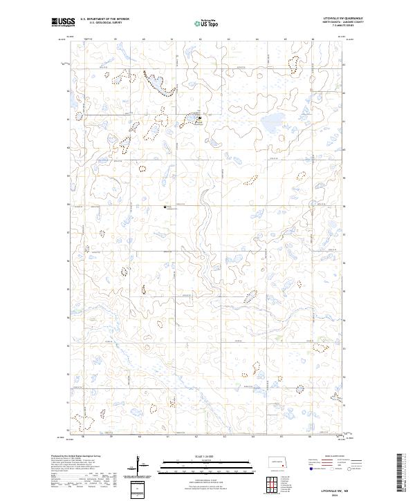
2024 Map of Litchville SW
USGS Topo · Published 2024About this map
The Lamoure County Waterfowl Production Area occupies a prominent section of the northwest corner of this quadrangle, illustrating the importance of conservation in this prairie pothole region. The landscape is defined by a dense network of wetlands and small lakes that influence the local road grid, which includes routes like Co Rd 60 and Co Rd 35. Cultural landmarks are concentrated along these section lines, notably the First Reformed Church and its associated First Reformed Church Cem. Further south, the Trinity Lutheran Church and Trinity Lutheran Cem serve as long-standing community focal points. This survey provides a precise look at the township and range boundaries of LaMoure County, highlighting how the rural infrastructure navigates the natural hydrology of the North Dakota plains.
Find a feature on this map
26 named features on this map. Tap any name to fly to it.
Don’t see what you’re looking for? This feature index may not catch every label — zoom into the map to look around manually.
Map Details
Editions of this 2024 Litchville SW Map
This is the sole edition of this map. No revisions or reprints were ever made.
Other maps of this area

1894 · La Moure
USGS Topo · 1:62,500

1895 · Lamoure
USGS Topo · 1:125,000

1897 · Eckelson
USGS Topo · 1:125,000

1918 · La Moure
USGS Topo · 1:125,000

1952 · Grand Rapids
USGS Topo · 1:24,000

1953 · Jamestown
USGS Topo · 1:250,000

1956 · Jamestown
USGS Topo · 1:250,000

1970 · Litchville
USGS Topo · 1:24,000
1970 · Hastings
USGS Topo · 1:24,000
1970 · Verona NW
USGS Topo · 1:24,000
Featured Places
- Litchville Township, ND
- Prairie Township, ND
- Black Loam Township, ND
- Gladstone Township, ND
- LaMoure County, ND