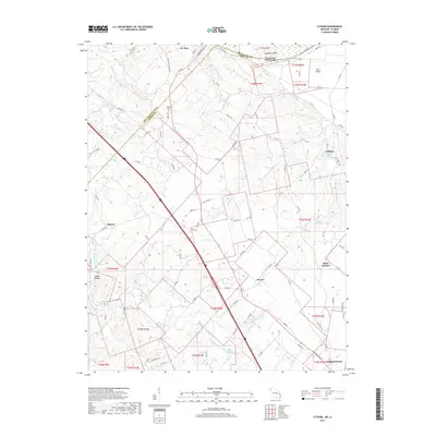
2017 Map of Lithium
USGS Topo · Published 2017About this map
The community of Lithium and its namesake Lithium Spring anchor the eastern edge of this Missouri survey, which traces the complex drainage of the Saline Creek watershed. This landscape is defined by its karst topography and historical river dynamics, most notably where Kaskaskia Island and the Old River mark the shifting boundary between Illinois and Missouri. The terrain transitions from the lowlands of Bois Brule to the more dissected uplands of Guittar Hollow, punctuated by small settlements like Brewer and Giboney. Local history is preserved in sites such as Brown Cem and the unique geological feature Ball Mill Resurgence. The infrastructure here shows a dense network of county roads, including Co Rd 834 and PCR 910, which connect these rural homesteads to larger hubs like St. Mary and the northern outskirts of Perryville.
Find a feature on this map
91 named features on this map. Tap any name to fly to it.
Don’t see what you’re looking for? This feature index may not catch every label — zoom into the map to look around manually.
Map Details
Editions of this 2017 Lithium Map
This is the sole edition of this map. No revisions or reprints were ever made.
Other maps of this area

1907 · Weingarten
USGS Topo · 1:62,500

1909 · Weingarten
USGS Topo · 1:62,500

1910 · Higdon
USGS Topo · 1:62,500

1915 · Chester
USGS Topo · 1:62,500

1923 · Perryville
USGS Topo · 1:62,500

1924 · Perryville
USGS Topo · 1:62,500

1947 · Chester
USGS Topo · 1:62,500

1949 · Paducah
USGS Topo · 1:250,000

1949 · Rolla
USGS Topo · 1:250,000

1950 · Paducah
USGS Topo · 1:250,000