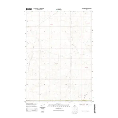
2013 Map of Little Butte NE
USGS Topo · Published 2013About this map
Tractor Flat occupies the central expanse of this 2013 survey, where the high desert terrain of eastern Idaho meets the administrative boundaries of three counties. The landscape is defined by its isolation and the practical infrastructure of the public land survey system, specifically within Township 4 North and Township 5 North. Local transit through this arid region relies on a sparse network of functional routes, including EBR 2 Rd and Sheep Rd, which trace the undulations of the terrain. Near the southern edge, the Twin Butte Sage Junction Rd skirts the tri-county corner where Jefferson, Bingham, and Bonneville counties converge. The map illustrates a transitional zone primarily used for grazing or specialized travel, marked by subtle elevation changes rather than dense settlement.
Find a feature on this map
10 named features on this map. Tap any name to fly to it.
Don’t see what you’re looking for? This feature index may not catch every label — zoom into the map to look around manually.
Map Details
Editions of this 2013 Little Butte NE Map
This is the sole edition of this map. No revisions or reprints were ever made.
Other maps of this area

1955 · Idaho Falls
USGS Topo · 1:250,000

1958 · Idaho Falls
USGS Topo · 1:250,000

1964 · Kettle Butte NW
USGS Topo · 1:24,000

1964 · Kettle Butte SW
USGS Topo · 1:24,000

1964 · Terreton
USGS Topo · 1:24,000

1969 · Antelope Butte
USGS Topo · 1:24,000

1969 · Circular Butte
USGS Topo · 1:24,000

1973 · Little Butte NE
USGS Topo · 1:24,000

1973 · Little Butte NW
USGS Topo · 1:24,000

1973 · Little Butte SW
USGS Topo · 1:24,000