
1964 Map of Kettle Butte SW
USGS Topo · Published 1965About this map
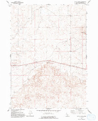
The National Reactor Testing Station occupies a significant portion of this Idaho landscape, marking a period of intense scientific and nuclear research in the mid-1960s. The terrain is defined by extensive formations of Lava, reflecting the volcanic history of the Snake River Plain. Prominent geographic landmarks like Kettle Butte and Twentymile Rock break the horizon, providing essential orientation points in an otherwise arid and isolated environment. Evidence of human utility and transit appears in the form of a Jeep Trail and a Taylor Well, along with several Borrow Pits that suggest local material extraction for infrastructure. This survey captures a moment when government research and high-desert geology converged, showing the physical footprint of the atomic age set against prehistoric basalt flows.
Find a feature on this map
7 named features on this map. Tap any name to fly to it.
Don’t see what you’re looking for? This feature index may not catch every label — zoom into the map to look around manually.
Map Details
Editions of this 1964 Kettle Butte SW Map
2 editions found
Other maps of this area

1955 · Idaho Falls
USGS Topo · 1:250,000

1958 · Idaho Falls
USGS Topo · 1:250,000

1964 · Kettle Butte NE
USGS Topo · 1:24,000

1964 · Kettle Butte NW
USGS Topo · 1:24,000
1964 · Morgans Pasture NE
USGS Topo · 1:24,000
1964 · Butterfly Butte
USGS Topo · 1:24,000

1973 · Little Butte NE
USGS Topo · 1:24,000

1973 · Little Butte
USGS Topo · 1:24,000

1973 · Taber NE
USGS Topo · 1:24,000
1978 · Blackfoot
USGS Topo · 1:100,000