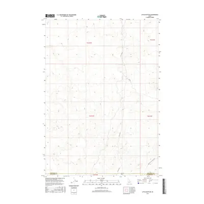
2017 Map of Little Butte NE
USGS Topo · Published 2017About this map
Tractor Flat anchors the southern portion of this high desert landscape, where the borders of Jefferson, Bingham, and Bonneville counties converge. This 2017 survey by the U.S. Geological Survey documents a region defined by its wide, open reaches and a sparse network of service roads. The geography is primarily a remote expanse of sagebrush and rolling topography, typical of the Snake River Plain's fringes. Transportation through this interior relies on a few critical corridors such as W Mud Lake Rd and Sheep Rd, which provide access across the township and range lines of T4N and T5N. The presence of Twin Butte Sage Junction Rd in the southeast corner indicates the primary route connecting this area to more established junctions outside the quadrangle.
Find a feature on this map
11 named features on this map. Tap any name to fly to it.
Don’t see what you’re looking for? This feature index may not catch every label — zoom into the map to look around manually.
Map Details
Editions of this 2017 Little Butte NE Map
This is the sole edition of this map. No revisions or reprints were ever made.
Other maps of this area

1955 · Idaho Falls
USGS Topo · 1:250,000

1958 · Idaho Falls
USGS Topo · 1:250,000

1964 · Kettle Butte NW
USGS Topo · 1:24,000

1964 · Kettle Butte SW
USGS Topo · 1:24,000

1964 · Terreton
USGS Topo · 1:24,000

1969 · Antelope Butte
USGS Topo · 1:24,000

1969 · Circular Butte
USGS Topo · 1:24,000

1973 · Little Butte NE
USGS Topo · 1:24,000

1973 · Little Butte NW
USGS Topo · 1:24,000

1973 · Little Butte SW
USGS Topo · 1:24,000