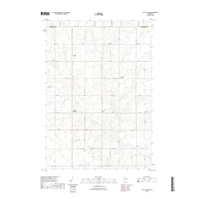
2018 Map of Little Chicago
USGS Topo · Published 2018About this map
Little Chicago and Naugart anchor this central Wisconsin landscape at the border of Lincoln Co and Marathon Co. The terrain is defined by the winding paths of the Little Rib River and the W Fork Little Rib River, which carve through a rural grid of country roads such as Co Rd F and Naugart Dr. The area's cultural history is remarkably well-preserved in its numerous burial grounds, including the Dreieinigkeit Cem and Saint Johns Cem. Genealogists will find a high density of named family and community cemeteries such as Zion Cem, Big Hill Cem, and the unique Rest Haven Pet Cem. Further south, Artus Cr drains the land near the Emanuel Cem, illustrating a long-standing pattern of small-scale agriculture and established rural settlements that characterize the Hamburg area.
Find a feature on this map
28 named features on this map. Tap any name to fly to it.
Don’t see what you’re looking for? This feature index may not catch every label — zoom into the map to look around manually.
Map Details
Editions of this 2018 Little Chicago Map
This is the sole edition of this map. No revisions or reprints were ever made.
Other maps of this area

1899 · Wausau
USGS Topo · 1:125,000

1902 · Wausau
USGS Topo · 1:125,000

1902 · Marathon
USGS Topo · 1:125,000

1951 · Merrill
USGS Topo · 1:48,000

1951 · Hamburg
USGS Topo · 1:48,000

1953 · Wausau
USGS Topo · 1:48,000

1953 · Marathon
USGS Topo · 1:48,000

1954 · Iron Mountain
USGS Topo · 1:250,000

1955 · Green Bay
USGS Topo · 1:250,000

1959 · Iron Mountain
USGS Topo · 1:250,000