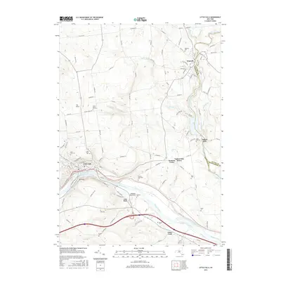
2016 Map of Little Falls
USGS Topo · Published 2016About this map
Little Falls sits as a primary hub along the Mohawk River and the Erie Canal, marking a historic corridor of New York transportation and industry. The landscape is defined by the sharp descent of the river, with the Herkimer Monument standing near the banks as a tribute to the region's Revolutionary War history. To the north, the industrial character of Dolgeville is visible where East Canada Creek and Spruce Creek converge, providing the water power that once fueled the village's expansion.
Find a feature on this map
116 named features on this map. Tap any name to fly to it.
Don’t see what you’re looking for? This feature index may not catch every label — zoom into the map to look around manually.
Map Details
Editions of this 2016 Little Falls Map
This is the sole edition of this map. No revisions or reprints were ever made.
Other maps of this area

1898 · Canajoharie
USGS Topo · 1:62,500

1900 · Little Falls
USGS Topo · 1:62,500

1900 · Canajoharie
USGS Topo · 1:62,500

1901 · Lassellsville
USGS Topo · 1:62,500

1902 · Canajoharie
USGS Topo · 1:62,500

1903 · Richfield Springs
USGS Topo · 1:62,500

1903 · Lassellsville
USGS Topo · 1:62,500

1903 · Little Falls
USGS Topo · 1:62,500

1939 · Little Falls
USGS Topo · 1:62,500

1943 · Jordanville
USGS Topo · 1:24,000