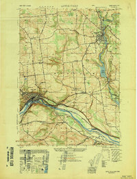
1949 Map of Little Falls
USGS Topo · Published 1949About this map
The Mohawk River corridor and the industrial activity of Little Falls define this mid-century landscape. The map captures a complex transportation hub where the New York Central Railroad parallels the Erie Barge Canal, demonstrating the heavy infrastructure required to move goods through the valley. Beyond the river, the terrain rises toward Notch Mountain, revealing a rural network of schoolhouses like School No 4 and School No 9 alongside established churches such as Yellow Ch.
Find a feature on this map
57 named features on this map. Tap any name to fly to it.
Don’t see what you’re looking for? This feature index may not catch every label — zoom into the map to look around manually.
Map Details
Editions of this 1949 Little Falls Map
This is the sole edition of this map. No revisions or reprints were ever made.
Other maps of this area

1898 · Canajoharie
USGS Topo · 1:62,500

1900 · Little Falls
USGS Topo · 1:62,500

1900 · Canajoharie
USGS Topo · 1:62,500

1901 · Lassellsville
USGS Topo · 1:62,500

1902 · Canajoharie
USGS Topo · 1:62,500

1903 · Richfield Springs
USGS Topo · 1:62,500

1903 · Lassellsville
USGS Topo · 1:62,500

1903 · Little Falls
USGS Topo · 1:62,500

1939 · Little Falls
USGS Topo · 1:62,500

1943 · Jordanville
USGS Topo · 1:24,000